Exploring Case Studies in Urban Planning Drawings: Real-World Applications for Students

- The High Line: Transforming Urban Infrastructure
- Barcelona's Superblocks: Redefining Public Spaces
- Curitiba: Pioneering Sustainable Urban Planning
- Masdar City: Designing for the Future
- Cheonggyecheon Restoration: Reclaiming Urban Waterways
- Conclusion:
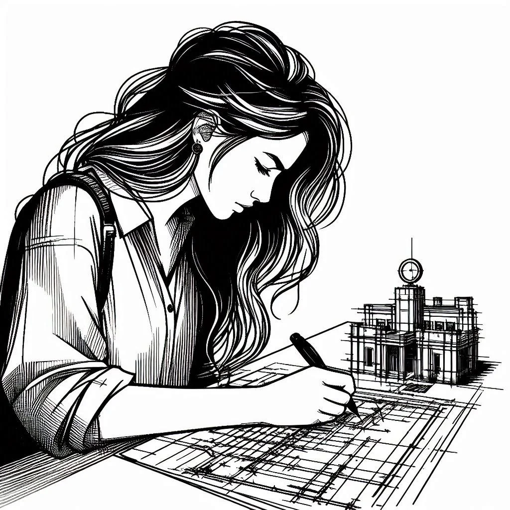
Urban planning drawings serve as blueprints for shaping the cities of tomorrow, translating ideas into tangible designs that can transform urban landscapes. For students aspiring to enter the field of urban planning, studying real-world case studies provides invaluable insights into the practical applications of these drawings. By examining successful projects from around the globe, students can gain a deeper understanding of the complexities and possibilities inherent in urban planning. Take, for instance, the High Line in New York City, a prime example of how urban planning drawings can revitalize abandoned infrastructure. Through detailed drawings and renderings, students can analyze how this elevated railway line was transformed into a vibrant public space, seamlessly blending nature with industrial heritage. The High Line showcases the power of innovative design in repurposing disused structures and revitalizing urban neighborhoods. Similarly, Barcelona's Superblocks initiative demonstrates how urban planning drawings can reimagine the use of city streets. By evaluating architectural drawings and plans, students can understand how these superblocks prioritize pedestrians and cyclists over vehicular traffic, creating safer, greener, and more livable neighborhoods. Barcelona's Superblocks offer valuable lessons in community engagement and sustainable urban design. Moving on to Curitiba, Brazil, renowned for its innovative approaches to urban planning, students can study architectural drawings and strategic plans associated with Curitiba's transit-oriented development and green infrastructure projects, learning how the city has prioritized sustainability, social equity, and economic prosperity. Curitiba's initiatives offer inspiration for creating resilient and inclusive cities.
Then there's Masdar City in the United Arab Emirates, showcasing the integration of advanced technology and renewable energy in urban planning. Through architectural drawings and plans, students can explore how Masdar City utilizes sustainable design principles to create a carbon-neutral urban environment, serving as a model for designing cities that are both environmentally sustainable and technologically advanced. Lastly, the Cheonggyecheon Restoration project in Seoul, South Korea, exemplifies how urban planning drawings can reclaim and restore natural waterways within urban environments .By analyzing ecological assessments and design drawings, students can understand how Cheonggyecheon transformed from a neglected stream to a vibrant public space, fostering ecological restoration and cultural revitalization. These case studies collectively offer practical insights into the role of urban planning drawings in shaping the built environment, providing students with a holistic understanding of the challenges and opportunities in urban planning and design, essential for completing an urban planning drawings assignment.
The High Line: Transforming Urban Infrastructure
The High Line, a former elevated railway line in New York City, stands as a quintessential example of transformative urban infrastructure. Spanning over a mile through Manhattan's West Side, its conversion into a vibrant public space has not only revitalized the area but also reshaped perceptions of urban renewal. This ambitious project, borne out of collaboration between architects, landscape designers, and community stakeholders, showcases the power of adaptive reuse in urban planning. Through meticulous evaluation of architectural drawings, renderings, and strategic plans, it becomes evident how the High Line seamlessly integrates nature with industrial heritage, offering a respite from the bustling city below. Its elevated vantage point provides visitors with unique perspectives of the urban landscape, fostering a sense of connection and exploration.
What sets the High Line apart is its innovative approach to repurposing disused infrastructure. Rather than demolishing the railway viaduct, designers embraced its historic significance and reimagined it as a linear park—a bold departure from conventional urban development practices. By preserving elements of the railway's industrial character, such as rail tracks, steel beams, and exposed brickwork, the High Line pays homage to its past while embracing its future as a dynamic public space. This blend of past and present creates a distinctive ambiance that resonates with visitors and locals alike, fostering a sense of pride and ownership in their shared urban environment.
Moreover, the High Line's success lies not only in its physical transformation but also in its social and economic impact. The park has become a magnet for tourists and locals alike, attracting millions of visitors annually and generating significant revenue for nearby businesses. Its presence has spurred a renaissance in the surrounding neighbourhoods, with new residential developments, art galleries, and cultural institutions springing up along its route. This revitalization effect, known as the "High Line effect," underscores the park's role as a catalyst for neighbourhood regeneration and economic growth.
Beyond its immediate surroundings, the High Line has also inspired similar adaptive reuse projects in cities around the world. From the Promenade Plantée in Paris to the Bloomingdale Trail in Chicago, urban planners and designers have looked to the High Line as a model for transforming obsolete infrastructure into vibrant public spaces. This global impact speaks to the enduring legacy of the High Line as a symbol of creative urban placemaking and community engagement.
Barcelona's Superblocks: Redefining Public Spaces
Barcelona's Superblocks initiative represents a pioneering approach to urban planning, aimed at reclaiming streets from vehicular traffic and prioritizing pedestrians and cyclists. This innovative concept seeks to transform the city's grid-like layout into a network of interconnected superblocks, or "superilles," where residents can enjoy safer, greener, and more vibrant public spaces. By evaluating the architectural drawings, plans, and strategic interventions associated with the Superblocks project, it becomes apparent how Barcelona is redefining the relationship between people and their urban environment.
At the heart of the Superblocks concept is the idea of reallocating road space to prioritize pedestrians and cyclists, thereby promoting active mobility and reducing pollution. By reconfiguring streets within designated superblocks, Barcelona aims to create car-free zones where people can walk, cycle, and socialize freely. This shift towards sustainable transportation not only improves air quality and reduces noise pollution but also fosters a sense of community and well-being among residents.
Architectural drawings and renderings of Barcelona's Superblocks showcase a variety of design elements aimed at enhancing the quality of public spaces. From tree-lined boulevards and pocket parks to outdoor seating areas and playgrounds, these plans prioritize greenery and pedestrian comfort. By incorporating elements of placemaking and tactical urbanism, Barcelona seeks to create inviting and inclusive environments where people of all ages can gather, interact, and engage in leisure activities.
Furthermore, Barcelona's Superblocks initiative emphasizes the importance of community participation and social cohesion in urban planning. Through extensive consultation with residents, businesses, and local stakeholders, the city has sought to ensure that Superblocks reflect the needs and aspirations of the people who live and work within them. By fostering a sense of ownership and pride in their neighborhoods, Barcelona aims to build stronger, more resilient communities that are better equipped to address the challenges of urbanization.
Curitiba: Pioneering Sustainable Urban Planning
Curitiba, Brazil, stands as a beacon of innovation in sustainable urban planning, with its visionary approaches serving as a model for cities worldwide. At the core of Curitiba's success lies a series of pioneering initiatives that have transformed the city into a vibrant, liveable, and environmentally conscious metropolis. By examining the architectural drawings, strategic plans, and policy frameworks associated with Curitiba's urban planning endeavours, it becomes evident how the city has prioritized sustainability, social equity, and economic prosperity in its development trajectory.
One of Curitiba's most renowned initiatives is its integrated transit system, known as the Rede Intergrade de Transported (RIT). Through strategic investments in bus rapid transit (BRT) infrastructure and urban design, Curitiba has created a highly efficient and accessible public transportation network that serves as the backbone of its mobility strategy. Architectural drawings and renderings of the RIT showcase dedicated bus lanes, modern terminals, and innovative station designs, all aimed at enhancing the user experience and encouraging modal shift away from private car usage. By prioritizing public transit over individual automobile travel, Curitiba has reduced traffic congestion, air pollution, and greenhouse gas emissions, while improving mobility and connectivity for residents across the city.
In addition to its transit system, Curitiba has implemented a range of sustainability initiatives aimed at preserving natural resources and enhancing the quality of life for its residents. Architectural drawings of urban parks, green spaces, and pedestrian-friendly boulevards illustrate how the city has integrated nature into its urban fabric, providing residents with access to recreational opportunities and promoting biodiversity. Furthermore, Curitiba's innovative waste management system, which includes recycling incentives and household composting programs, has helped minimize landfill waste and reduce environmental pollution.
Masdar City: Designing for the Future
Masdar City, located in the United Arab Emirates, stands as a bold testament to the possibilities of sustainable urban development in the 21st century. Conceived as a pioneering eco-city, Masdar City aims to demonstrate how advanced technology, renewable energy, and innovative design can create a thriving urban environment while minimizing environmental impact. By exploring the architectural drawings, strategic plans, and cutting-edge technologies associated with Masdar City, it becomes evident how the project is shaping the future of urban living.
Central to Masdar City's vision is its commitment to carbon neutrality and renewable energy. Architectural drawings of the city showcase innovative design features such as rooftop solar panels, wind towers for natural ventilation, and district cooling systems powered by renewable energy sources. These sustainable technologies not only reduce carbon emissions and energy consumption but also enhance the comfort and well-being of residents and workers within the city. By harnessing the power of renewable energy, Masdar City demonstrates how cities can transition to a low-carbon future while meeting the needs of a growing population.
In addition to its focus on renewable energy, Masdar City prioritizes resource efficiency and waste reduction. Architectural drawings of water-saving technologies, such as greywater recycling systems and xeriscaping, illustrate how the city minimizes water consumption and conserves precious resources in its arid desert environment. Furthermore, Masdar City's commitment to zero waste aims to minimize landfill waste through recycling, composting, and innovative waste-to-energy solutions. By adopting a circular economy approach, Masdar City demonstrates how cities can reduce their ecological footprint and promote sustainable consumption and production patterns.
Masdar City also serves as a hub for research, innovation, and education in sustainable technology and urban planning. Architectural drawings of research laboratories, academic institutions, and innovation centers illustrate how the city fosters collaboration and knowledge exchange among scientists, engineers, and entrepreneurs from around the world. Through initiatives such as the Masdar Institute of Science and Technology and the Masdar City Free Zone, the city attracts leading researchers and companies in fields such as renewable energy, clean technology, and sustainable design, positioning itself as a global leader in the transition to a sustainable future.
Cheonggyecheon Restoration: Reclaiming Urban Waterways
The Cheonggyecheon Restoration project in Seoul, South Korea, stands as a testament to the transformative power of reclaiming urban waterways. Once a neglected and polluted stream buried beneath layers of concrete and urban sprawl, Cheonggyecheon has been revitalized into a vibrant public space that serves as a model for urban renewal worldwide. By examining the architectural drawings, strategic plans, and ecological assessments associated with the Cheonggyecheon Restoration project, it becomes evident how Seoul has reimagined its relationship with its natural environment, fostering sustainability, connectivity, and cultural revitalization.
At the heart of the Cheonggyecheon Restoration project is the idea of reconnecting people with nature within the heart of the city. Architectural drawings of the restored stream showcase a meandering waterway flanked by native vegetation, walking paths, and public plazas, creating a tranquil oasis amidst the bustling urban landscape. By reintroducing natural elements into the built environment, Seoul has not only improved the aesthetic quality of the city but also enhanced the ecological integrity of the area, providing habitat for wildlife and improving air and water quality for residents.
Furthermore, the Cheonggyecheon Restoration project has catalyzed economic revitalization and cultural renewal in the surrounding neighborhoods. Architectural drawings of pedestrian bridges, waterfront promenades, and cultural landmarks illustrate how the restored stream has become a focal point for recreation, tourism, and community engagement. By creating opportunities for social interaction, artistic expression, and economic activity along its banks, Cheonggyecheon has become a symbol of Seoul's commitment to creating livable, inclusive, and sustainable urban spaces.
The success of the Cheonggyecheon Restoration project can be attributed to Seoul's holistic approach to urban planning and design. Architectural drawings of flood control measures, water treatment facilities, and green infrastructure demonstrate how the city has addressed the complex challenges of managing stormwater runoff and mitigating the risk of flooding in a densely populated urban environment. By incorporating principles of sustainable water management and ecological restoration into its planning process, Seoul has transformed Cheonggyecheon into a resilient and adaptive urban ecosystem that can withstand the impacts of climate change and support biodiversity.
Conclusion:
Urban planning case studies offer invaluable insights into the complexities and possibilities of shaping the cities of tomorrow. From the revitalization of abandoned infrastructure to the creation of sustainable communities and the restoration of urban waterways, each case study presents unique challenges, innovations, and lessons that can inform and inspire the next generation of urban planners, designers, and policymakers.
By examining real-world examples such as the High Line in New York City, Barcelona's Superblocks, Curitiba's sustainable initiatives, Masdar City in the United Arab Emirates, and the Cheonggyecheon Restoration project in Seoul, students can gain a deeper understanding of the principles and practices of urban planning. Architectural drawings, strategic plans, and ecological assessments associated with these projects provide concrete examples of how innovative design, community engagement, and sustainable technologies can transform urban environments and improve the quality of life for residents.
Moreover, urban planning case studies offer opportunities for interdisciplinary learning and collaboration. By exploring the intersection of architecture, landscape design, transportation planning, environmental science, and social equity, students can develop a holistic understanding of the complex factors that shape urban development. By integrating diverse perspectives and approaches, cities can create more resilient, inclusive, and sustainable communities that are better equipped to address the challenges of the 21st century.
Furthermore, urban planning case studies serve as sources of inspiration and innovation for cities around the world. By sharing best practices, lessons learned, and success stories, cities can learn from each other's experiences and adapt proven strategies to their own unique contexts. Whether it's repurposing abandoned infrastructure, reimagining public spaces, or embracing renewable energy and green technologies, cities can draw upon the wealth of knowledge generated by urban planning case studies to create more liable, equitable, and sustainable urban environments for all.
By incorporating case studies into their learning journey, students can bridge the gap between theory and practice, cultivate their design skills, and develop a holistic perspective on urban planning challenges and opportunities.
Similar Blogs
AutoCAD assignments can be challenging, but you don’t have to face them alone. Our dedicated team provides comprehensive help, from solving complex problems to offering step-by-step explanations. Enhance your understanding and complete your assignments with confidence.